
Call Anytime
512-508-8373- ClearedDirect > Blog > Drone And LiDAR Guides > UAV Drone Mapping vs Surveying: Every Aspect You Need to Know Before Hiring a Drone Service
Blog Details

UAV Drone Mapping vs Surveying: Every Aspect You Need to Know Before Hiring a Drone Service
Not long ago, surveys meant hours of ground crews walking a site with total stations, tripods, and measuring rods. The process was slow, labor-intensive, and often limited by how much ground people could realistically cover in a day. Compare that to the present, where a single flight with a UAV can capture a landscape in incredible detail, delivering results in hours instead of weeks.
This shift explains why drones are reshaping surveying and mapping across industries. They provide faster access to accurate terrain data, reduce field time, and open opportunities that once required extensive manpower. Yet, despite their growing use, there’s still plenty of confusion about what separates UAV surveying from UAV mapping. The two terms are often used interchangeably, but they don’t always mean the same thing, and the difference matters when you’re deciding how to approach a project.
In this guide, we’ll clear up those misconceptions. You’ll learn the difference between surveying and mapping, the role of technologies like UAV mapping and UAV for aerial mapping, and where LiDAR fits in. We’ll also look at the challenges that can impact results, when each approach should be used, and what you should expect when hiring a drone service.
By the end, you’ll have a complete picture of what these services really involve, so you can make confident, informed choices without relying on buzzwords.
Drone Surveying vs Drone Mapping: What’s The Difference
What’s the difference between drone surveying vs drone mapping, to answer this, we need to focus on what each process is designed to deliver.
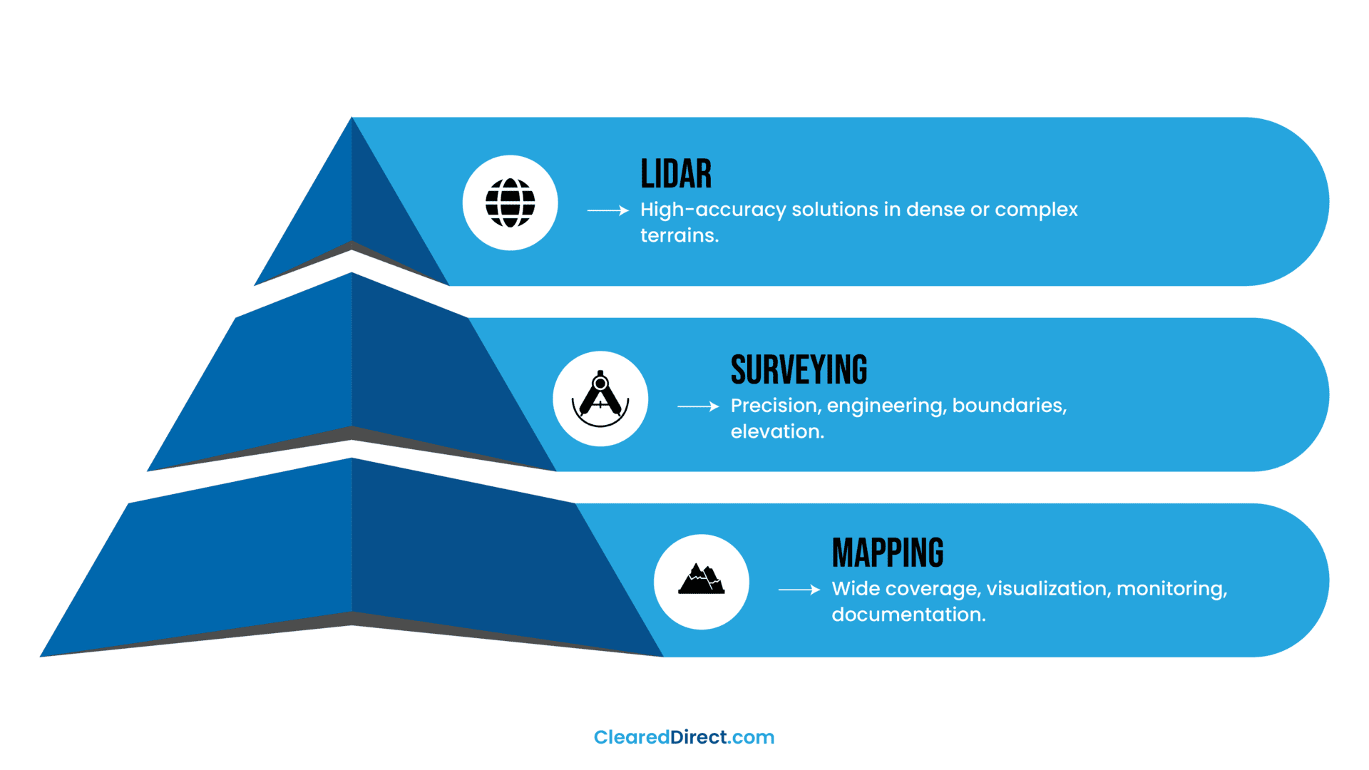
UAV drone surveying is the practice of using a UAV to capture precise, measurable data. The goal is accuracy you can trust for engineering or legal purposes.
When surveyors use drones, they’re not just taking pictures; they’re collecting georeferenced data tied to real-world coordinates. Technologies like LiDAR, RTK, or PPK corrections are often part of the workflow, along with ground control points to ensure measurements meet professional standards.
This type of surveying is especially valuable in construction, mining, and infrastructure projects where a few centimeters can make a critical difference.
Drone Mapping works differently. Instead of striving for centimeter-level precision, mapping uses overlapping aerial images to create orthomosaic maps and 3D reconstructions.
It gives you the “big picture” view of a site, making it easier to monitor changes, plan logistics, or share visual updates with stakeholders. Many companies provide UAV mapping services that deliver high-resolution imagery to track agricultural health, check progress on a job site, or build terrain models for general planning. While not always as precise as surveying, mapping has the advantage of speed, accessibility, and flexibility across a wide range of projects.
The two terms often get mixed up because, on the surface, they look similar. Both involve UAVs flying grids across a site, both create digital outputs, and both can produce 3D models. The difference lies in intent.
Surveying answers questions like “exactly how steep is this slope?” or “where is the legal boundary of this parcel?” Mapping, on the other hand, answers questions like “what does the site look like now?” or “how has the project area changed since last month?”
For businesses that want rapid insights without investing in full survey-grade precision, UAVfor aerial mapping often becomes the preferred choice.
LiDAR in Drone Surveying and Mapping
What LiDAR Is and How It Works
Have you ever wondered how UAVs can measure the shape of the ground even when trees, brush, or other obstacles are in the way? That’s where LiDAR comes in. If you’re new to this technology, you can learn more in our guide: What is LiDAR Technology and How Does It Work?
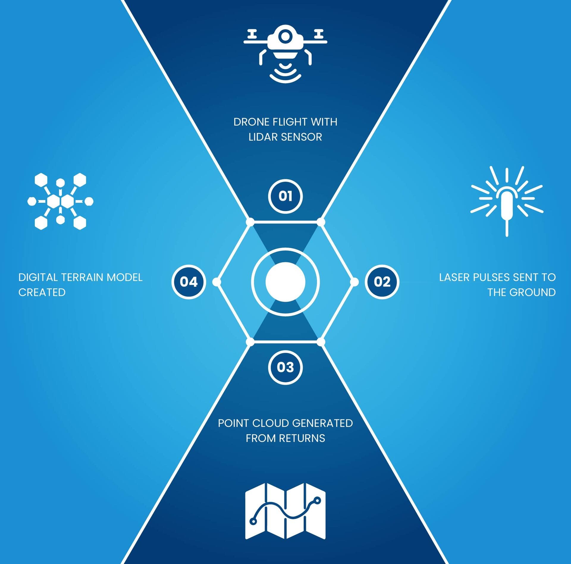
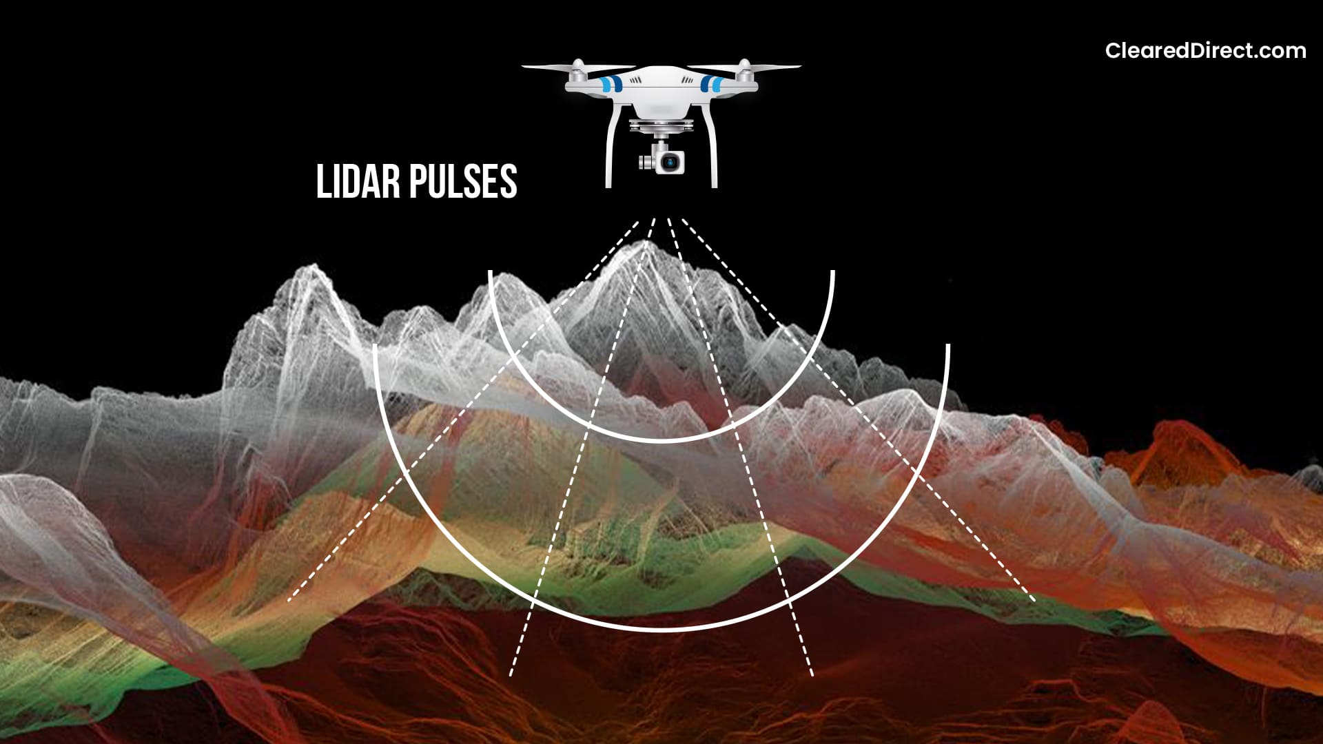
LiDAR (Light Detection and Ranging) uses rapid laser pulses to measure distances with extreme precision. Mounted on a UAV, the sensor fires thousands of beams per second toward the ground, each bouncing back with information about the terrain. By combining all these return signals, LiDAR produces a highly accurate 3D model of the landscape, even penetrating tree canopies or dense vegetation.
Why LiDAR Matters for High-Accuracy Surveys
This is where LiDAR stands apart from traditional imaging methods. Photogrammetry builds models from stitched photos, but LiDAR captures direct distance measurements.
That means surveyors get not just visuals but reliable metric data. For projects that demand centimeter-level accuracy such as infrastructure inspections, detailed topographic studies, or water management, LiDAR has become essential.
It is one of the most advanced techniques available in UAV for aerial mapping today.
How Drone Surveying and Mapping Work Differently
When people hear the words surveying and mapping, they often imagine the same process. In reality, they operate on very different levels of precision and purpose, even though both use UAVs as the main platform.
Surveying: Precision and Ground Truth
UAV surveying is about accuracy that ties directly to the real world. Each point of data is georeferenced, meaning it is locked to exact geographic coordinates. To achieve this, surveyors often use control points on the ground and correction systems that enhance GPS accuracy. The end result is centimeter-level data that engineers, architects, and land developers can use with confidence. If you are defining legal boundaries, measuring elevation changes, or calculating earthwork volumes, this is the level of detail you need.
Mapping: Visualization and Coverage
UAV drone mapping, by contrast, focuses on building a visual model of the terrain.
By flying systematic patterns, a UAV collects hundreds or thousands of overlapping images, which are later stitched into large mosaics or 3D reconstructions. The result is a high-resolution view of an area that shows how it looks in detail but does not always carry the same positional accuracy as a survey.
This is why UAV mapping services are often used for site monitoring, agricultural assessments, or progress documentation rather than legal or engineering decisions.
How LiDAR Bridges the Two Approaches
LiDAR technology has become the connecting point between these two methods. By firing laser pulses and recording their returns, LiDAR builds a point cloud that can serve both needs: it delivers visual representations like a map while also providing highly accurate elevation data.
In areas with dense vegetation or complex terrain, LiDAR can capture what standard imagery might miss, making it an ideal tool for projects where both visualization and measurement matter.
It brings surveying-level precision into mapping workflows, pushing the boundaries of what UAVs can deliver.
Challenges in UAV Surveying and Mapping
Every technology comes with limitations, and UAV drone surveying is no exception. Being aware of these challenges helps set realistic expectations and ensures projects are designed with the right approach.
Weather and Environmental Obstacles
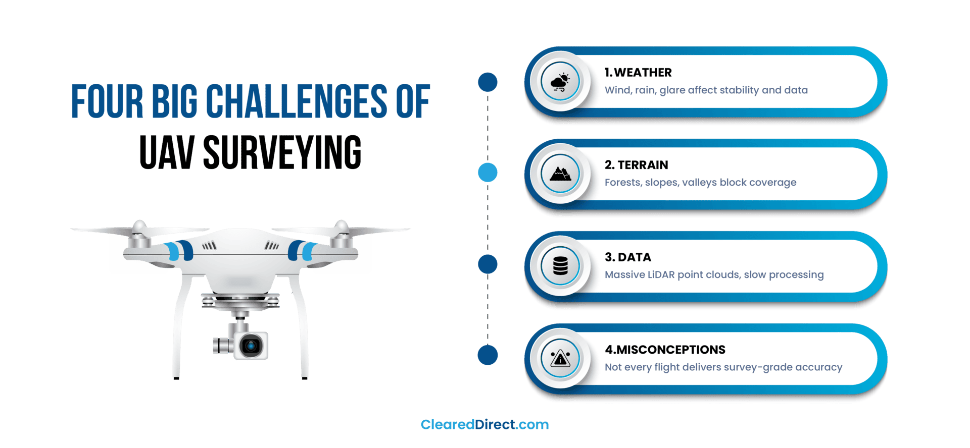
UAV drones may be advanced, but they are still vulnerable to natural conditions. Strong winds can reduce flight stability, rain can interfere with sensors, and glare from the sun can affect image quality.
For projects requiring high precision, flights often need to be postponed until conditions improve. Even with UAV mapping systems, careful scheduling around weather forecasts is essential to protect equipment and maintain data accuracy.
Terrain and Accessibility Issues
Not all locations are easy to survey. Areas with dense forests, steep hills, or narrow valleys make it harder for UAVs to maintain consistent coverage. LiDAR helps by penetrating vegetation, but line-of-sight limitations remain a challenge. Sometimes, surveyors must plan multiple flights or use creative flight paths to cover the entire site.
Data Volume and Complexity of LiDAR vs Imagery
LiDAR sensors are powerful, but they generate enormous datasets. Millions of data points are recorded in a single flight, which requires advanced software and significant processing time.
Image-based mapping produces smaller files, but stitching and aligning hundreds of photos still demands precision. For clients expecting instant results, this step can feel slower than anticipated. To see practical guidance on managing big LiDAR point clouds, readers can dive into Esri’s best-practice guide.
Misconceptions About “Survey-Grade” Results
A common misconception is assuming that every drone survey automatically produces survey-grade results. In truth, accuracy depends on ground control points, correction methods, and the type of sensor used.
Without these steps, the output may look impressive but lack the accuracy required for engineering or legal use. Clear communication between providers and clients is critical to avoid misunderstandings.
When to Use Drone Surveying vs Mapping
Choosing between drone surveying and mapping depends on what the project actually needs. Some situations call for high-accuracy measurements, while others only require detailed visuals. Understanding these differences avoids wasted effort and ensures that the right UAV mapping services are applied.
Below is a breakdown of scenarios where each approach makes sense:
| Use Case | Best Fit | Why It Matters |
|---|---|---|
Construction site progress photos | Mapping | Visual records and stakeholder updates don’t require centimeter accuracy. |
Agricultural crop monitoring | Mapping | Orthomosaics and NDVI imagery track health and patterns effectively. |
Legal boundary determination | Surveying | Requires georeferenced accuracy tied to control points. |
Engineering design (roads, bridges, utilities) | Surveying | Precise elevation models and measurements are essential. |
Vegetated or forested areas | Surveying with LiDAR | LiDAR penetrates canopy to deliver bare-earth models |
General terrain visualization | Mapping | Wide coverage provides context without complex processing. |
How LiDAR Changes the Decision
LiDAR often tips the balance in favor of surveying when the environment is complex. In heavily wooded areas, dense urban landscapes, or rugged terrain, traditional image stitching may not capture enough reliable data. LiDAR’s ability to generate accurate elevation models and point clouds makes it the preferred option when both precision and visualization are needed.
What to Expect When Hiring a Drone Service
Hiring a UAV drone provider can look different depending on the scope of the project. For large engineering surveys, the process may be very detailed with multiple stages. For smaller mapping tasks, it might be only a few steps. What matters is that the workflow is clear and appropriate for the project’s goals.
The Typical Process
Here are the stages you can expect in most cases:
- Consultation: Discussing the purpose of the project and whether it requires precise surveying or broader mapping.
- Planning: Reviewing site conditions, flight paths, safety measures, and any permissions needed.
- Flight: Conducting the UAV operation to collect data, whether through aerial imagery or LiDAR.
- Processing: Turning raw data into usable outputs such as orthomosaics, 3D models, or elevation maps.
- Delivery: Providing the final results in the requested formats, along with explanations if needed.
Not every provider follows all of these stages, but the important thing is that the service adapts to the project. A good provider explains what will be included and why.
Questions to Ask a Provider
Before choosing a UAV service, it helps to ask direct questions such as:
- How much experience do you have with projects like mine?
- What technology or sensors will you be using?
- What kind of deliverables should I expect, and in what formats?
- How long will it take from the flight to delivery?
- Do you use ground control points or LiDAR when accuracy is critical?
Red Flags to Watch For
There are also warning signs that suggest a service may not meet expectations:
- Promises of “survey-grade accuracy” without explaining how it will be achieved.
- Vague answers about deliverables, formats, or project timelines.
- Overly quick turnaround times that don’t match the complexity of the job.
- Lack of transparency about experience or past projects.
Why Alignment Matters
The key to success is making sure your needs and the provider’s capabilities align. If you need centimeter-level accuracy, you should not settle for simple UAV mapping services that only deliver visuals. Likewise, if you only need a broad site overview, you don’t need to pay for a full survey. A reliable provider will clarify this early on, saving you from wasted effort or budget.
Ready to take your surveying to the next level? Explore our survey-grade drone LiDAR mapping service designed for unmatched accuracy and reliable terrain data.
Summing-up
Drone surveying and drone mapping may use the same UAV platforms, but their purposes are distinct. Mapping provides broad visualization for planning and monitoring, while surveying delivers georeferenced measurements that support engineering and legal decisions. LiDAR strengthens both approaches by combining accurate elevation data with detailed visuals, especially in challenging terrain.
We’ve also looked at the common challenges including weather, terrain, heavy datasets, and misconceptions about accuracy, and why matching your goals with the right service matters. Knowing these differences ensures you can ask better questions and avoid costly mistakes.
ClearedDirect provides LiDAR services as part of its UAV surveying and mapping solutions. If your project requires advanced accuracy or if you are unsure which approach best fits your needs, our team can guide you through the options. You can always reach out to us for support and advice tailored to your specific project.
Frequently Asked Questions
Surveying is the process of collecting precise measurements tied to geographic coordinates, often used for engineering and legal purposes. LiDAR is one of the tools that makes surveying possible, using laser pulses to generate accurate elevation data. In short, surveying is the discipline, and LiDAR is a technology that supports it within UAV mapping services.
A drone is the flying platform, also called an Unmanned Aerial Vehicle (UAV), that carries sensors into the air. LiDAR is a specific sensor mounted on the drone that uses lasers to measure the terrain below. Without the drone, LiDAR cannot fly; without the sensor, the drone is just a carrier.
The biggest advantage is its ability to capture accurate elevation data even in areas with dense vegetation or difficult terrain. LiDAR penetrates tree canopies and records the bare earth surface, making it invaluable for projects that require reliable topographic models. This is why LiDAR is often chosen for UAV mapping in forestry, floodplain analysis, and infrastructure projects.
No. Both measure distance by sending signals and recording their return, but they use different forms of energy. Radar uses radio waves, while LiDAR uses laser light. The shorter wavelength of laser beams allows LiDAR to capture much finer detail, which is why it is widely used in UAV 3d mapping for high-precision surveys.
References
https://www.thedroneu.com/blog/drone-surveying/
https://birdseyeaerialdrones.com/how-drone-mapping-services-are-revolutionizing-land-surveys/
https://thecloudstrap.com/uavs-for-surveying-and-mapping/

Kevin Milewski
Kevin Milewski is the Chief Operating Officer at ClearedDirect, where he oversees operational strategy, technology implementation, and service delivery for aviation and commercial drone (UAV) projects. With a strong background in aviation services and facility management, Kevin focuses on improving safety, efficiency, and regulatory compliance across complex airport and industrial environments. At ClearedDirect, Kevin leads initiatives integrating drone surveillance, LiDAR imaging, and AI-driven facility inspection systems that help clients achieve higher safety and performance standards. His leadership contributes to the company’s commitment to precision, reliability, and data-driven decision-making in critical infrastructure operations. Kevin regularly contributes insights to ClearedDirect’s knowledge hub, covering UAV surveillance, aviation operations, and facility optimization topics. His work reflects practical industry experience and a dedication to advancing innovation in aviation and technology management. Connect with Kevin on LinkedIn to learn more about his work.
RECENT POSTS


Recent Comments
CATEGORIES
- Aviation Facility Management
- Commercial Cleaning
- Construction
- Digital Mapping & Analytics
- Drone & LiDAR Inspections
- Drone And LiDAR Guides
- Facility Cleaning Resources
- Facility Management Guides
- Facility Management Risk
- Facility Management Technology
- Facility Operations
- Facility Security Management
- Identifying & Eliminating Inefficiencies
- Operations Management Guides
- Process Optimization
- Security Management Guides
- Staffing Augmentation Guides
- Surveillance UAV Drone Guides
- UAV Drone Mapping
- Uncategorized
TAGS
2025 facility trends aerial surveillance aircraft cleaning airline operations airport compliance management airport operational risk management airport personnel airport terminal operations Aviation Operations Aviation Risk Management aviation security risk assessment aviation services AviationStaffing aviation staffing Commercial Cleaning Services Commercial Drone Surveillance Commercial Facility Security Drone Surveying Emergency Response Planning Facility Hygiene Compliance facility maintenance facility management Facility Risk Assessment Facility risk management facility services Green Cleaning for Facilities ground handling services integrated facility management services Operational Efficiency Strategies operations management outsource facility management outsourcing airline services outsourcing airport services passenger experience enhancement Physical Security Best Practices proactive maintenance Scaling janitorial operations seasonal peaks staff augmentation Staffing Augmentation Staffing Challenges Aviation terminal facility security TSA FAA risk mitigation uav infrastructure inspection uav lidar technology
Leave a Comment