
Drone LiDAR Survey & Mapping Services in Austin, TX
Accurate, survey-grade data for developers, engineers, and surveyors – Delivered faster and safer with advanced drone LiDAR.
0.5cm accuracy · NDAA/Blue-compliant hardware · Bid-ready deliverables
Professional UAV LiDAR Services Trusted Across
Engineering and Infrastructure Projects
UAV LiDAR projects are executed using defined acquisition parameters and controlled processing standards to ensure consistent terrain outputs across large and complex sites. This approach supports reliable use of LiDAR data in engineering design, infrastructure planning, and regulated project environments.
0.5cm Vertical Precision
LiDAR measurement accuracy suitable for engineering and survey applications
Up to 2 Million Points per Second
Up to 2,000,000 Points per Second High- density data capture for detailed terrain modeling
300+ Acres per Mission
Efficient coverage for large and complex project sites
NDAA/Blue-Compliant UAV Platforms
Qualified systems for government and regulated projects
What is UAV LiDAR Technology?
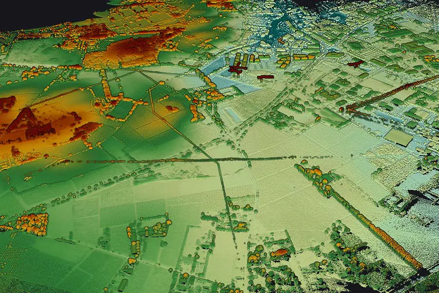
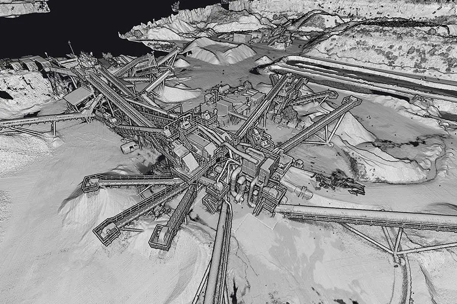
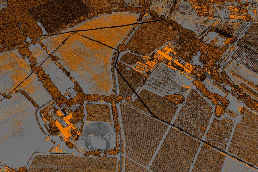
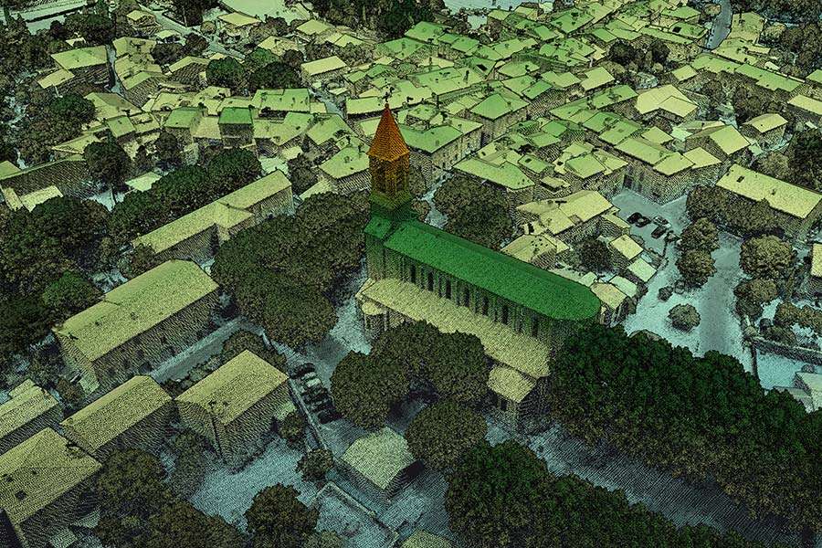
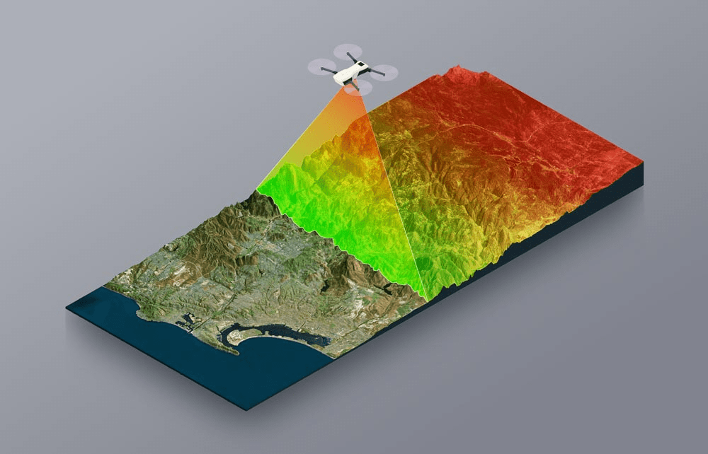
UAV LiDAR – short for Light Detection and Ranging – uses a laser sensor mounted on a drone to collect accurate terrain data from the air. As the drone flies over a site, it fires laser pulses at the ground and measures how they bounce back, capturing up to 2,000,000 readings per second. That data is then processed into 3D point clouds, digital terrain models, and other engineering-ready outputs.
The main advantage over photogrammetry is that LiDAR works through vegetation. Where photogrammetry relies on images and can’t see past tree cover, UAV LiDAR captures true ground elevations even in wooded or uneven terrain making it a better fit for topographic surveys, flood analysis, and infrastructure planning. It also cuts field time significantly compared to traditional ground-based surveying.
5X FASTER
Than traditional aerial survey methods
Why Choose ClearedDirect for UAV LiDAR Services?
ClearedDirect operates as a professional drone as a service provider, combining enterprise-grade UAV LiDAR systems with local operational expertise to deliver reliable terrain data that meets engineering and public-sector requirements, without the cost and complexity of large national providers.
Cost-Effective LiDAR Mapping
Enterprise-grade UAV LiDAR is delivered through project-based pricing suited for sites of all sizes. This approach provides access to high-quality LiDAR data without the overhead of large surveying firms.
NDAA/Blue-Compliant UAV Platforms
UAV LiDAR operations use NDAA/Blue-compliant platforms that meet federal procurement requirements. This enables participation in DOT, FEMA, municipal, and other regulated infrastructure projects.
Efficient LiDAR Data Collection
Optimized UAV LiDAR flight plans support efficient coverage of large and complex sites. Field time is reduced while maintaining consistent data quality across projects.
Experienced LiDAR Survey Teams
UAV LiDAR projects are supported by FAA Part 107 certified pilots and field teams. Local experience across Central Texas terrain supports reliable site operations.
Engineering-Ready Terrain Deliverables
LiDAR data is processed into digital terrain models ready for engineering use. Outputs integrate directly with Civil 3D, ArcGIS, and common GIS platforms.
Clear, Transparent Pricing
LiDAR project pricing is defined upfront based on site conditions and scope. This ensures predictable budgeting for single-site and multi-site projects.

Professional Drone Mapping Services Deliverables
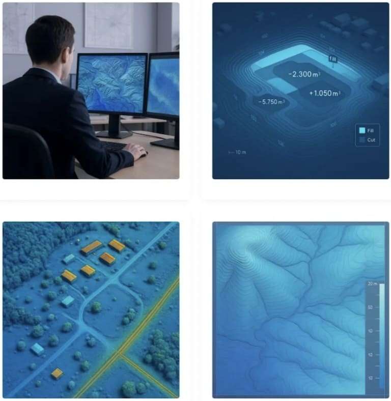
Every UAV lidar project includes professionally processed data and terrain models formatted for immediate use in engineering, drone surveying services, and GIS applications.
Classified Point Clouds (LAS/LAZ)
Digital Terrain Models (DTM)
Digital Surface Models (DSM)
Orthomosaic Maps (GeoTIFF)
Volumetric Calculations
Cross-Sections & Profiles
CAD Files (DWG, DXF)
GIS Formats (SHP, KML, XML)
UAV LiDAR System Technical Specifications
Point Collection Rate
Up to 2,000,000 points per second for high-density terrain capture
Vertical Accuracy
-0.5cm accuracy when operated with RTK/PPK positioning
Horizontal Accuracy
Approximately 1 cm typical under standard operating conditions
Maximum Measurement Range
Effective LiDAR range exceeding 440 meters
Returns per Laser Pulse
Up to 32 discrete returns for improved vegetation and ground detection
Scanner Field of View
100° scanner for comprehensive terrain coverage
Experienced LiDAR Survey Teams
Coverage per Mission Up to 300 acres per flight within a typical 30-minute mission
Positioning System
Integrated RTK/PPK GNSS with base station support
System Reference
YellowScan Voyager UAV LiDAR system deployed on NDAA-compliant UAV platforms
Industries We Serve with UAV LiDAR Mapping Services
LiDAR mapping is applied across a wide range of engineering, infrastructure, and environmental projects. Survey-grade terrain data supports planning, design, and analysis workflows across diverse site conditions throughout Central Texas.
Construction
UAV LiDAR mapping supports site planning, earthwork calculations, and as-built documentation. Terrain data integrates directly with Civil 3D workflows to support grading, cut and fill analysis, and construction progress tracking.
Use cases:
Grading plans · Cut and fill analysis · Foundation verification · Progress tracking
Land Development & Aerial Survey
Drone LiDAR mapping provides accurate terrain models for subdivisions, commercial developments, and master-planned communities. Elevation data is used early in the design process to support layout, drainage, and slope analysis.
Use cases:
Boundary surveys · Plat development · Easement mapping · Slope analysis
Transportation & Infrastructure
UAV LiDAR mapping supports corridor studies, right-of-way analysis, and infrastructure planning. Data collection aligns with TxDOT and federal requirements for transportation and utility-related projects.
Use cases:
Corridor mapping · Asset inventory · Clearance verification · Design surveys
Environmental & Conservation
LiDAR UAV data supports floodplain mapping, wetland delineation, and environmental assessment. Vegetation-penetrating LiDAR captures true ground elevations for erosion analysis and watershed planning.
Use cases:
FEMA flood studies · Erosion monitoring · Vegetation analysis · Watershed planning
Utilities & Energy
UAV drone mapping supports power line corridor surveys, pipeline planning, and renewable energy site assessment. Elevation and clearance data help identify encroachments and potential conflicts.
Use cases:
Transmission corridors · Solar site surveys · Pipeline monitoring · Substation mapping
Emergency Response & SAR
Rapid UAV LiDAR mapping supports disaster assessment and emergency response planning. Terrain data is used for flood damage analysis, wildfire mapping, and post-event documentation when time is critical.
Use cases:
Flood damage assessment · Wildfire mapping · SAR terrain modeling · Insurance documentation
How Our UAV Drone LiDAR Mapping Services Work
From initial consultation to final digital terrain model deliverables, our drone as a service handles every step with precision and professionalism.
01
Consultation & Planning
We assess your UAV drone survey requirements, determine optimal flight parameters, and provide detailed drone services pricing. We will help you decide if lidar drones, photogrammetry, or traditional methods best fit your needs.
02
Site Preparation & UAV Flight
Our FAA Part 107 pilots establish ground control points (GCPs), configure RTK/PPK positioning on our lidar UAV, and execute systematic flight patterns for comprehensive aerial drone survey coverage.
03
LiDAR Data Processing
Raw drone lidar data is processed using industry-standard software. Point clouds are classified, georeferenced, and quality checked to ensure they meet survey-grade accuracy standards for your digital terrain model.
04
Deliverable Production
We generate your requested outputs, including DTMs, DSMs, contours, CAD files, and more in formats compatible with your engineering and GIS workflows. Professional drone survey services are delivered within 3 to 5 business days.
LiDAR vs Photogrammetry and Traditional Surveying
Real Cost Savings
See how UAV drone mapping services deliver meaningful time and cost advantages compared to photogrammetry and conventional ground based surveying methods.
Traditional Survey
Ground-Based Survey
100-Acre site
5-7 Days
Typical Cost
$15,000+
Terrain Access
Limited
Vegetation Penetration
None
Point Density
Low
Lidar Drone Services
ClearedDirect UAV LiDAR
100-Acre site
1-2 Hours
LiDAR Drone Cost
$3,000-6,000
Terrain Access
Unlimited
Vegetation Penetration
Full
Point Density
Ultra-High
Photogrammetry
Photo-Based Mapping
100-Acre site
2-4 Hours
Typical Cost
$1,500-3,000
Terrain Access
Full
Vegetation Penetration
None
Point Density
High
*Drone services cost varies based on project complexity, site conditions, and deliverable requirements. Contact us for accurate lidar drone cost quotes.

About ClearedDirect

LiDAR Deliverables

Use Cases

Hardware Specs
Not Sure if LiDAR Is Right for You?

Positioned for Worldwide Service

Aviation Security Escort

TSA Employee Screening
Backed by Frontier Precision. Powered by YellowScan.
ClearedDirect partners with Frontier Precision to deliver industry-leading LiDAR mapping services throughout Central Texas.
Our team combines enterprise YellowScan LiDAR equipment (Voyager) with elite drone surveying expertise to provide 0.5cm vertical accuracy on your civil and environmental projects.
- True NDAA/Blue-compliant hardware and professional-grade outputs
- Our workflows align with DOT, FEMA, and other federal & state industry standards for accuracy and precision

Accurate, Fast, and Format-Ready
Ideal for Large Parcels & Complex Terrain
Sub‑2 cm Accuracy. NDAA-Approved. Built for Texas.
Our professional-grade equipment is specifically configured for the diverse environmental and infrastructure challenges throughout Central Texas. ClearedDirect’s drone fleet is field-optimized to produce engineering-grade results on large sites, in rugged terrain, and under time-sensitive conditions.
Not Sure if LiDAR Is Right for You?
We understand that different projects have different requirements.
Our team can help you determine whether drone LiDAR, photogrammetry, or traditional surveying methods are most appropriate for your specific site needs and budget.
Positioned for Worldwide Service
Based in Austin, we provide drone LiDAR mapping services throughout Central Texas, including Travis, Williamson, Hays, Bastrop, and surrounding counties.
For larger projects, we can mobilize to locations across Texas and the Southwest.
Contact Details:
 512-508-8373
 info@cleareddirect.com
 Austin, TX
Deliverables
- Classified point clouds (LAS/LAZ)
- Digital Elevation Models (DTM)
- Surface models (DSM)
- Camera maps (TIFF/GeoTIFF)
- Volumetric calculations
- Cross-sections & profiles
- CAD-ready deliverables (DWG, DXF)
- GIS-compatible formats (SHP, XML)
Usable For:
- Civil Engineering
- Construction
- Land Development
- Utilities & Infrastructure
- Transportation
- Environmental/Conservation
- Emergency Response
Service Benefits
- Up to 610,000 points per second collection rate
- Penetrates vegetation to capture true ground surface
- NDAA-compliant hardware for government projects
- RTK/PPK-GPS for precise geolocation
- 30-minute flight coverage up to 150 acres per mission

Service Benefits
Service Benefits

Looking for the Best Solution?
Contact Us Today!
Ready to Start Your UAV LiDAR Project?
Whether the goal is civil engineering design, land development, environmental analysis, or infrastructure planning, survey grade UAV LiDAR mapping provides reliable terrain data for informed decisions. Project teams receive accurate digital terrain models delivered on time and aligned with defined scope and budget expectations.
Positioned for Worldwide Service
Based in Austin, we provide drone LiDAR mapping services throughout Central Texas, including Travis, Williamson, Hays, Bastrop, and surrounding counties. For larger projects, we can mobilize to locations across Texas and the Southwest. Contact Details:
512-508-8373
info@cleareddirect.com
- 512-508-8373
- info@cleareddirect.com
- Austin, TX
Request Free Drone Services Pricing
Tell us about your UAV drone survey project and we’ll respond within 24 hours.